Yorkshire flooding: Local residents urged to ‘stay away from beaches, promenades, coastal footpaths and roads’ as warnings issued for Yorkshire coast and East Yorkshire including Whitby, Bridlington, Staithes, Hornsea and Hull

and live on Freeview channel 276
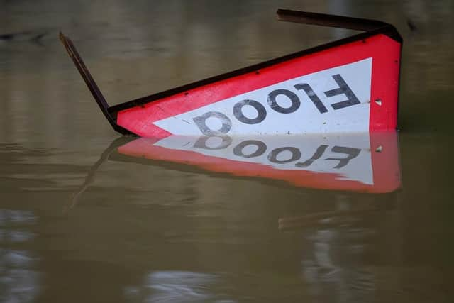
The Met Office has published various flood warnings and alerts across the country including various areas in Yorkshire.
Local coastal/tidal flooding is possible along parts of the coasts of North East England and Yorkshire and the Humber today (April 8) and Tuesday, April 9, 2024. Lands, roads and some properties may flood and there could be travel disruption.
Advertisement
Hide AdAdvertisement
Hide AdLocal inland flooding is also possible in parts of North West England today and Tuesday due to a period of heavy rain. Residents of various areas of the Yorkshire coast are urged to stay away from coastal areas and roads.

Flood warnings in Yorkshire
North Bank of the Humber estuary at Hessle Haven
This flood warning has been issued due to strong winds, surge and high spring tides on the coast from today and across the coming days.
Flooding is predicted to impact properties along the Humber estuary in Hessle and Hessle Haven between 6pm and 7.45pm today, and again on Tuesday between 7am and 8am.

The Flood Warning included this message: “Stay away from beaches, promenades, coastal footpaths and roads as the expected large waves and sea spray will be dangerous. Consider enacting your flood plan.”
Flooding will impact the Hessle area around Hessle Haven.
North Bank of the Humber estuary at North Ferriby
Advertisement
Hide AdAdvertisement
Hide AdStrong winds, surge and high spring tides on the coast have resulted in this flood warning from today and over the coming days.

Flooding is predicted to impact properties along the Humber estuary and on the East side of Humber Road and the south side of Ings Lane, as well as properties on Redcliffe and Southfield Drives in North Ferriby between 6pm and 7pm today.
Residents of the affected properties and areas are again warned to stay away from beaches, promenades, coastal footpaths and roads and to enact a flood plan.
North Bank of the Humber estuary from Kilnsea to Skeffling and Weeton
Advertisement
Hide AdAdvertisement
Hide AdThis flood warning has also been issued as a result of strong winds, surge and high spring tides on the coast from today and over the coming days.
The warning stated: “Overtopping waves and flooding is forecast to affect properties in the Kilnsea, Skeffling and Weeton areas between 3.45pm and 9pm today, and again Tuesday between 5am and 7.45am.
“We will continue to monitor levels closely. Stay away from beaches, promenades, coastal footpaths and roads as the expected large waves and sea spray will be dangerous. Consider enacting your flood plan.”
North Bank of the Humber estuary in the east of Hull
This flood warning has been issued as a result of strong winds, surge and high spring tides on the coast from today and over the coming days.
Advertisement
Hide AdAdvertisement
Hide AdThe Flood Warning stated: “Wave overtopping and flooding is forecast to affect properties along the North Bank of the Humber estuary in the East of Hull between 6.30pm and 8.45pm today.
“We will continue to monitor the forecast and levels closely. Stay away from beaches, promenades, coastal footpaths and roads as the expected large waves and sea spray will be dangerous. Consider enacting your flood plan.”
North Bank of the Humber estuary in the west of Hull
This flood warning has been issued due to strong winds, surge and high spring tides on the coast from today and across the next few days.
The warning stated: “Flooding is forecast to affect properties along the North Bank of the Humber estuary in the West of Hull between 6.15pm and 7.15pm today. We will continue to monitor levels.
Advertisement
Hide AdAdvertisement
Hide Ad“Stay away from beaches, promenades, coastal footpaths and roads as the expected large waves and sea spray will be dangerous. Consider enacting your flood plan.”
The flood warning areas are the Humber Dock Basin, Riverside Quay and St Andrew’s Quay, areas south of the A63/Hessle Road as far as the railway line, and Henry Boot Way.
North Bank of the River Ouse at Saltmarshe, Sand Hall, Skelton and Kilpin Pike
Strong winds, surge and high spring tides have resulted in this flood warning on the coast and tidal River Ouse from today and over the coming days.
Advertisement
Hide AdAdvertisement
Hide AdThe warning stated: “Flooding is forecast to affect properties along the North Bank of the River Ouse between Saltmarshe and Howdendyke, including Skelton and Kilpin Pike between 7:15pm and 8:15pm today.
“We will continue to monitor the forecast and levels closely. Stay away from riverside footpaths and roads as the expected high tides and wave spray will be dangerous. Consider enacting your flood plan.”
North Sea coast at Bridlington - Harbour Road and Floral Pavilion
This flood warning has been issued due to strong winds, surge and high spring tides along the coast from today and across the coming days.
Advertisement
Hide AdAdvertisement
Hide AdThe warning stated: “Flooding is forecast to affect the North side of the dock area, properties on Harbour Road and the Floral Pavilion between 4.30pm and 6pm today, and again Tuesday between 5.30pm and 6.30pm.
“We will continue to monitor levels closely. Stay away from beaches, promenades, coastal footpaths and roads as the expected large waves and sea spray will be dangerous. Consider enacting your flood plan.”
North Sea at Staithes
The flood warning has been issued due to strong winds, surge and high spring tides on the coast from today and over the coming days.
The warning stated: “Flooding is forecast to affect properties bordering Staithes Beck, including those on Beckside and the High Street down to the Cod and Lobster public house between 4pm and 5pm today.
Advertisement
Hide AdAdvertisement
Hide Ad“We will continue to monitor levels closely. Stay away from beaches, promenades, coastal footpaths and roads as the expected large waves and sea spray will be dangerous. Consider enacting your flood plan.”
North Bank of the Humber estuary at Broomfleet, Faxfleet, Blacktoft and Yokefleet
This flood warning has also been a result of strong winds, surge and high spring tides on the coast and will be in place from today and over the coming days.
The warning stated: “Wave overtopping and flooding is forecast to affect properties along the Humber estuary from Broomfleet Island to Blacktoft, including Weighton Lock and Faxfleet between 7.45pm and 9pm today.
Advertisement
Hide AdAdvertisement
Hide Ad“We will continue to monitor the forecast and levels closely. Stay away from beaches, promenades, coastal footpaths and roads as the expected large waves and sea spray will be dangerous. Consider enacting your flood plan.”
North Sea and River Esk at Whitby Harbour
Another flood warning has been issued due to strong winds, surge and high spring tides on the coast from today and over the coming days.
The warning states: “Flooding is forecast to affect Whitby Harbour area including Abrahams Quay, Pier Road, New Quay Road, Church Street, Campion Dock and Bagdale Road between 3.45pm and 5pm today, and again Tuesday between 4.30PM and 5.45PM.
“We will continue to monitor levels closely. Stay away from beaches, promenades, coastal footpaths and roads as the expected large waves and sea spray will be dangerous. Consider enacting your flood plan.”
North Sea coast at Hornsea
Advertisement
Hide AdAdvertisement
Hide AdThis flood warning remains in place due to strong winds, surge and high spring tides.
The warning stated: “Wave and spray overtopping is possible today between 4.15pm and 7.15pm and again on Tuesday between 5am and 7.30am. This could cause some localised flooding.
“Areas most at risk of flooding include Marine Drive, along South Promenade, Hornsea Burton Road and along Stream Dike and Foss Beck. We are expecting higher than normal tides over the coming days and as a result we may issue further alerts/warnings.
“We will continue to monitor the situation closely. Stay away from beaches, promenades, coastal footpaths and roads as the waves and sea spray could be dangerous.”
North Sea coast at Bridlington - South Pier
Advertisement
Hide AdAdvertisement
Hide AdThis flood warning has been issued due to strong winds, surge and high spring tides on the coast from today and over the coming days.
The warning stated: “Wave overtopping is forecast to affect the South Pier and Chicken Run Jetty, and adjacent car parks off South Cliff Road between 4.30pm and 6pm today, and again Tuesday between 5.30pm and 6.30pm.
“We will continue to monitor levels closely. Stay away from beaches, promenades, coastal footpaths and roads as the expected large waves and sea spray will be dangerous. Consider enacting your flood plan.”
North Sea at Easington and Kilnsea
The flood warning has been issued due to strong winds, surge and high spring tides on the coast from today and over the coming days.
Advertisement
Hide AdAdvertisement
Hide AdThe warning stated: “Flooding is forecast to affect properties along the coast in Easington and Kilnsea, including caravan parks in these areas between 5pm and 6.45pm and again Tuesday between 6am and 7am.
“We will continue to monitor levels closely. Stay away from beaches, promenades, coastal footpaths and roads as the expected large waves and sea spray will be dangerous. Consider enacting your flood plan.”
Flooding alerts issued in Yorkshire
Humber estuary from Faxfleet to Saltmarshe
This flood alert has been issued due to strong winds, surge and high spring tides on the coast and tidal River Ouse from today and over the coming days.
The alert stated: “Flooding of low lying land and roads is possible between 7.15pm and 8.15 today. Areas most at risk include low lying land from Faxfleet to Howdendyke. We are expecting higher than normal tides over the next few days and as a result we may issue further alerts/warnings.
Advertisement
Hide AdAdvertisement
Hide Ad“We will continue to monitor levels closely. Be careful along the riverside, beaches, promenades, coastal footpaths and roads as high river levels, large waves and spray could be dangerous.”
Humber estuary from Lords Clough to Hessle Haven
This flood alert has been issued due to strong winds, surge and high spring tides on the coast from today and over the coming days.
The alert stated: “Flooding of low lying land and roads is possible between 6.15pm and 7.15pm today. Areas most at risk include low lying land from Lords Clough to Hessle Haven, including the river frontage in Hull.
“We are expecting higher than normal tides over the next few days and as a result we may issue further alerts/warnings. We will continue to monitor levels closely. Be careful along beaches, promenades, coastal footpaths and roads as large waves and sea spray could be dangerous.”
North Sea coast at Bridlington
Advertisement
Hide AdAdvertisement
Hide AdThis flood alert has been issued due to strong winds, surge and high spring tides on the coast from today and over the coming days.
The alert stated: “Flooding of low lying land and roads is possible between 4.30pm and 6pm today and again on Tuesday between 5.30pm and 6.30pm. Areas most at risk include the North Sea coast at Bridlington, particularly at the Lifeboat Station. We are expecting higher than normal tides over the next few days and as a result we may issue further alerts/warnings.
“We will continue to monitor levels closely. Be careful along beaches, promenades, coastal footpaths and roads as large waves and sea spray could be dangerous.”
Upper River Ouse
River levels remain high on the River Ouse due to recent rainfall.
Advertisement
Hide AdAdvertisement
Hide AdThe alert stated: “Flooding is possible on Riverside footpaths and low-lying land in York, and to the south as far as Naburn Lock, including Kings Staith, Queens Staith and South Esplanade.
“The River Ouse has peaked and is slowly falling. There is no significant rainfall forecast over the coming days. We will continue to monitor levels closely. Avoid using low lying footpaths and any bridges near local watercourses and do not attempt to walk or drive through flood water.”
North Sea coast at Skipsea, Hornsea and Mappleton
This flood alert remains in place due to strong winds, surge and high spring tides on the coast. Areas most at risk include the North Sea coast from Skipsea to Mappleton, including Hornsea.
The alert stated: “Flooding is possible today between 4.15pm and 7.15pm and again on Tuesday between 5am and 7.30am. We are expecting higher than normal tides over the next few days and as a result we may issue further alerts/warnings.
Advertisement
Hide AdAdvertisement
Hide Ad“We will continue to monitor levels closely. Be careful along beaches, promenades, coastal footpaths and roads as large waves and sea spray could be dangerous.”
North Sea coast at Withernsea, Easington and Kilnsea
This flood alert remains in place due to strong winds, surge and high spring tides on the coast. Areas most at risk include low lying land and roads in the Spurn Road and Southfield Farm areas.
The alert stated: “Flooding of coastal roads and footpaths along coast frontages is likely. Flooding is possible between 5.30pm and 8.15pm today and again on Tuesday between 6.15am and 9am.
“We are expecting higher than normal tides over the next few days and as a result we may issue further alerts/warnings. We will continue to monitor levels closely. Be careful along beaches, promenades, coastal footpaths and roads as large waves and sea spray could be dangerous.”
Advertisement
Hide AdAdvertisement
Hide AdNorth Sea coast from Staithes to Whitby including tidal River Esk
This flood alert remains in place due to strong winds, surge and high spring tides on the coast.
The alert stated: “Flooding of low lying land and roads is possible between 3.30pm and 5.15pm today and again on Tuesday between 4.45am and 5.30am. Areas at risk include the North Sea coast from Staithes to Whitby including Sandsend and the tidal River Esk.
“We are expecting higher than normal tides over the next few days and as a result we may issue further alerts/warnings. We will continue to monitor levels closely. Be careful along beaches, promenades, coastal footpaths and roads as large waves and sea spray could be dangerous.”
Humber estuary from Hessle Haven to Faxfleet
Advertisement
Hide AdAdvertisement
Hide AdThis flood alert remains in place due to strong winds, surge and high spring tides on the coast.
The alert stated: “Flooding of low lying land and roads is possible between 6.30pm and 8pm today. Areas most at risk include the Humber estuary from Hessle Haven to Faxfleet.
“We are expecting higher than normal tides over the next few days and as a result we may issue further alerts/warnings. We will continue to monitor levels closely. Be careful along beaches, promenades, coastal footpaths and roads as large waves and sea spray could be dangerous.”
Humber estuary from Spurn Point to Winestead Outfall
This flood alert remains in place due to strong winds, surge and high spring tides on the coast. Areas most at risk include Kilnsea Village and low lying land and roads along the Humber estuary from Spurn Point to Winestead Outfall.
Advertisement
Hide AdAdvertisement
Hide AdThe alert stated: “Flooding of coastal roads and footpaths along coast frontages is likely. Flooding is possible between 4pm and 5.30pm today and again on Tuesday between 7.45am and 9am.
“We are expecting higher than normal tides over the next few days and as a result we may issue further alerts/warnings. We will continue to monitor levels closely. Be careful along beaches, promenades, coastal footpaths and roads as large waves and sea spray could be dangerous.”